Clean up your first dataset
Rename cryptic fields, fix types, calculate a new column and publish the result, a spreadsheet pass over a whole layer, without touching its geometry.
Editing and publishing in the Data Editor requires the Editor role or higher. Viewers can open a dataset, sort, filter and export CSV.
Open the dataset
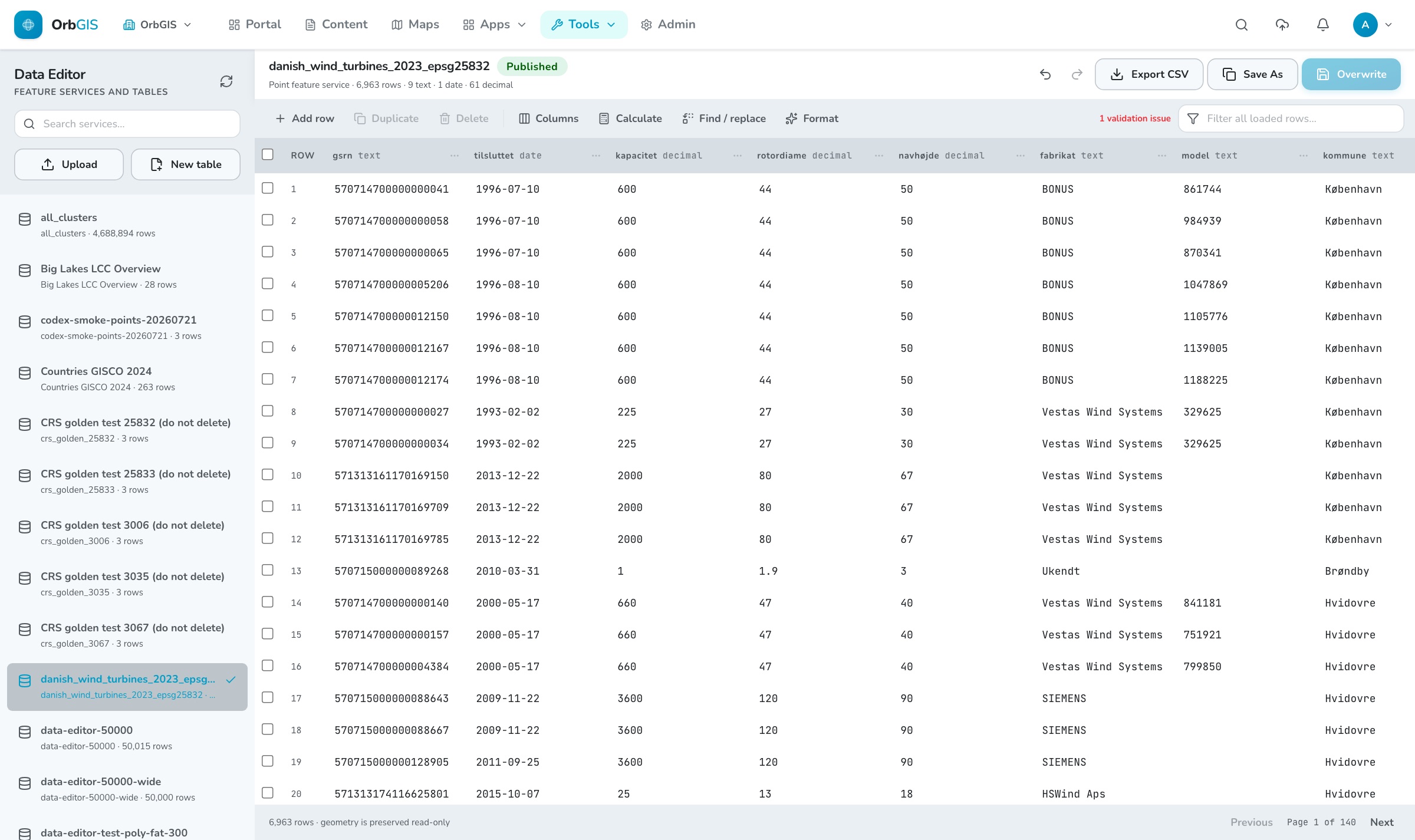
Go to Tools → Data Editor and pick a feature service or table from the library on the left, or open one from its item page with Open in Data Editor. The complete layer loads into a working copy in your browser; nothing is changed on the server until you publish.
Look before you edit
Click a column header to sort (ascending, descending, off), and use the filter box to search every loaded row at once. The footer shows the row count and reminds you that geometry is carried through read-only.
Fix the fields
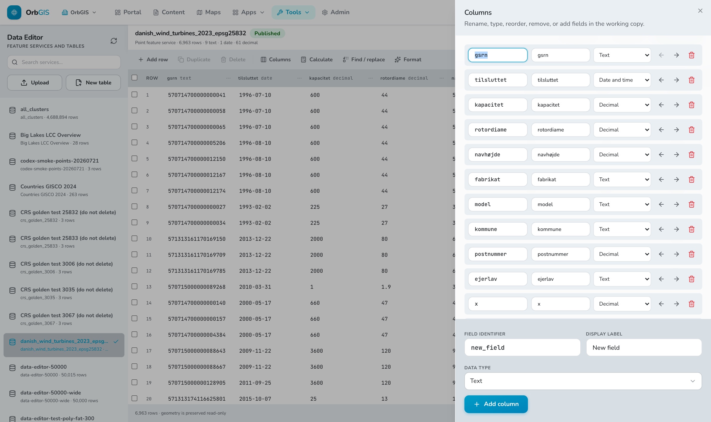
Open Columns. Rename a field identifier, give it a human display label, change its data type (Text, Integer, Decimal, Boolean, Date and time), reorder with the arrows, remove what you do not need, and add new fields at the bottom. Renaming migrates the values; retyping re-coerces them.
Calculate a column
Open Calculate, choose the target field, then how to fill it: a fixed value, a copy of another field, a text template with
{field}tokens, or a numeric operation on another field. Tick the box to limit it to the rows you have selected.Clean the text
Find / replace swaps matching text in one field across the dataset, with an optional case-sensitive match. Format applies bulk fixes: trim whitespace, upper/lower/title case, round to two decimals, convert to integer, normalize numbers, convert to ISO dates.
Edit rows
Click any cell to type in it, values are committed when you leave the cell and coerced to the column type. Add row, Duplicate and Delete work on the current selection. Invalid cells turn red and the toolbar counts the outstanding issues; undo is
Cmd/Ctrl+Z.Publish the result
Save As creates a new feature service and leaves the original untouched, the safe default. Overwrite replaces the source data in place while keeping the layer’s identity, so every map, dashboard and journey that already points at it picks up the new schema and rows.
What happens when you press Save#
The Data Editor never writes to the source table directly. It serializes your working copy to a file, stages it, and runs it through the same ingest pipeline as an upload, so the published result gets the same reprojection, indexing and automatic overviews as any other dataset. The progress card names each phase as the worker gets to it.
Limits worth knowing#
- A dataset must fit the browser: up to 500,000 rows and roughly 450 MB of attributes and geometry. Larger layers are better edited through the QGIS Connector.
- Geometry is never edited here, it is carried through untouched, in the layer’s own coordinate system.
- Managed fields (
objectid,globalid,created_atand friends) are hidden and cannot be reused as field names. - Any validation issue blocks saving until you fix it. Nothing is written half-way.
The working copy lives only in the browser tab, a refresh loses it. The full reference is in The Data Editor.