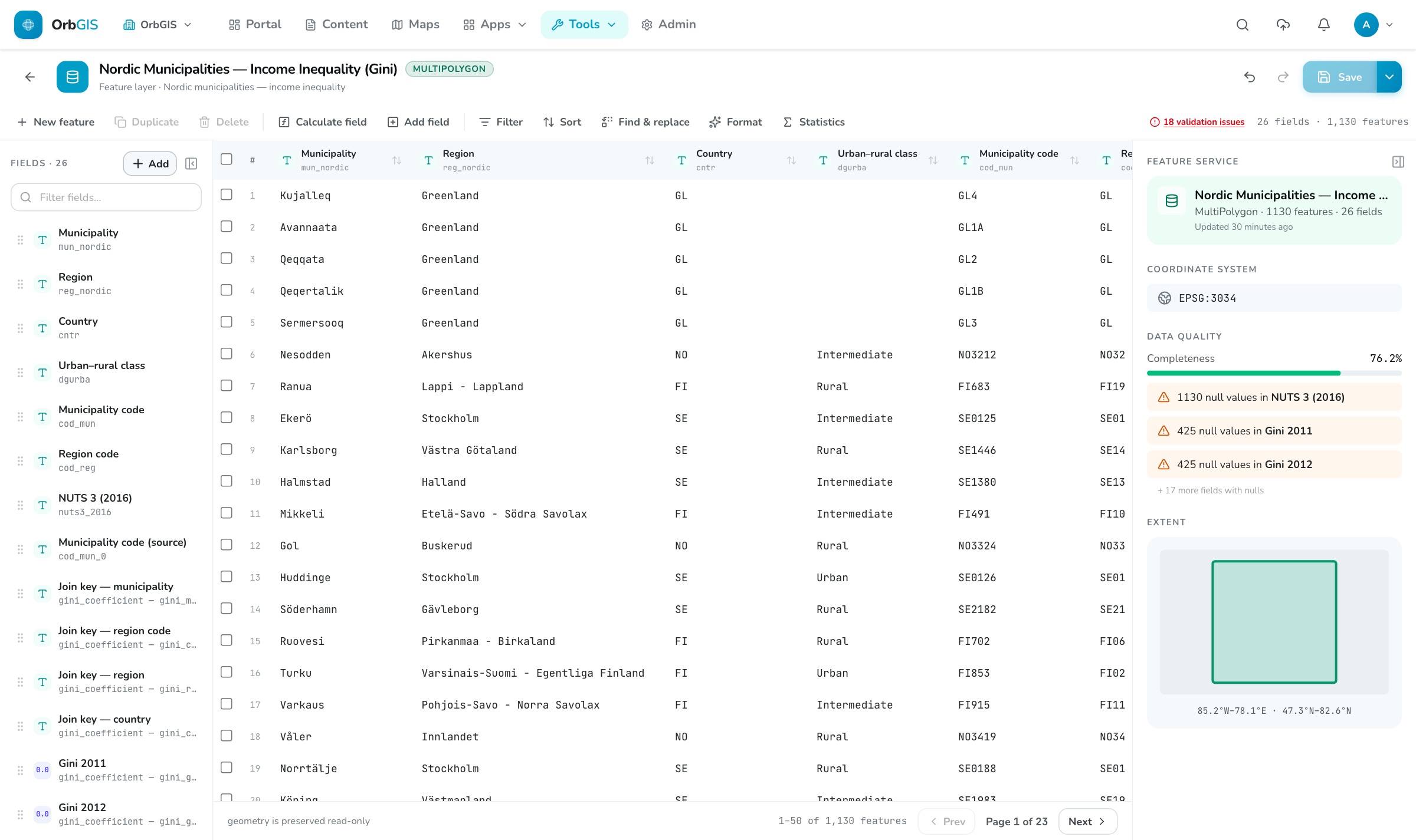
The Data Editor, spreadsheet editing on the same layer your maps render
Open any dataset or table as an editable spreadsheet in the browser: fix values, restructure fields, run bulk changes, then save the result as a new layer, or update the original so every map that uses it shows the new data.
The Data Editor, spreadsheet editing on the same layer your maps render
The Data Editor opens a complete working copy of a dataset, up to 500,000 rows, as an editable spreadsheet in the browser. Edit cells directly, add, duplicate or delete rows, and rename, reorder or change the type of columns. Geometry rides along read-only, and undo covers everything, all the way back to your first edit.
When you're done, you choose how to save. Save as new creates a fresh layer and leaves the original untouched. Overwrite updates the original in place, styling, sharing and every map and dashboard that uses the layer stay intact, and they all show the new data the moment the save finishes. It's safe, too: if someone else edited the layer while you worked, the save stops instead of overwriting their changes, and if you removed or renamed columns you're warned first.
Geometry editing lives where the tools for it already are: the free OrbGIS Connector adds the same layer to a QGIS project, lets you edit with QGIS's full toolbox and saves straight back to your portal. The two complement each other, attribute work at spreadsheet scale in the browser, geometry in QGIS. Saving changes requires the Editor role; read-only roles can still open any layer and export it as CSV.
Edit cells directly, add, duplicate and delete rows, and filter and sort while you work, with undo all the way back to your first change.
Rename, reorder, add and remove columns, or change their type: text, whole numbers, decimals, yes/no, and dates.
Calculate whole fields at once, find and replace per field, and one-click clean-ups: trim spaces, fix casing, round numbers, tidy dates.
Save as a new layer, or update the original in place, styling, sharing and every map that uses the layer follow along automatically.
If someone else edited the layer while you worked, your save stops instead of overwriting their changes, and removed columns are flagged before you commit.
Rename cryptic fields, fix types, calculate a new column and publish the result, a spreadsheet pass over a whole layer, without touching its geometry.
→A spreadsheet for your layers: clean, calculate, restructure and publish a dataset’s complete attribute table, without touching its geometry.
→Drop a file, get a layer. Uploads run in the background through a real ingest pipeline, reprojection, indexing, tiling and automatic overviews for large datasets.
→Datasets are OrbGIS’s working unit: hosted feature layers and attribute tables with typed fields, relationships, statistics, and vector tiles behind every map.
→No demo call. No sales funnel. Sign up to make your first map.