The survey builder, nine question types, live preview, answers as map data
Forms that collect map data. Build a survey, publish it, and every answer lands in a live layer you can put straight on a map, the location answer becomes a point.
The survey builder, nine question types, live preview, answers as map data
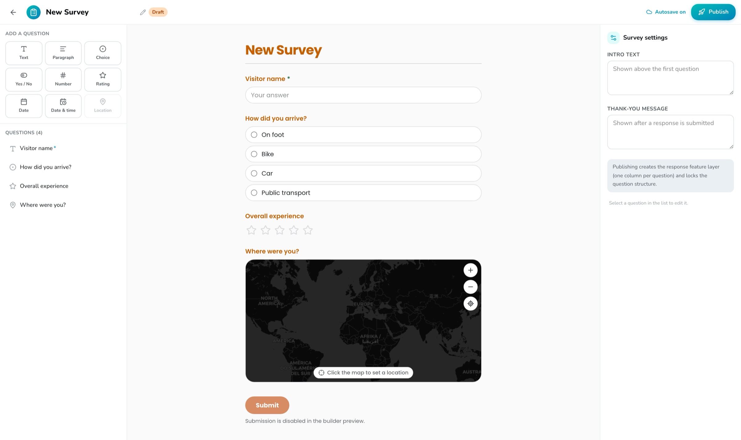
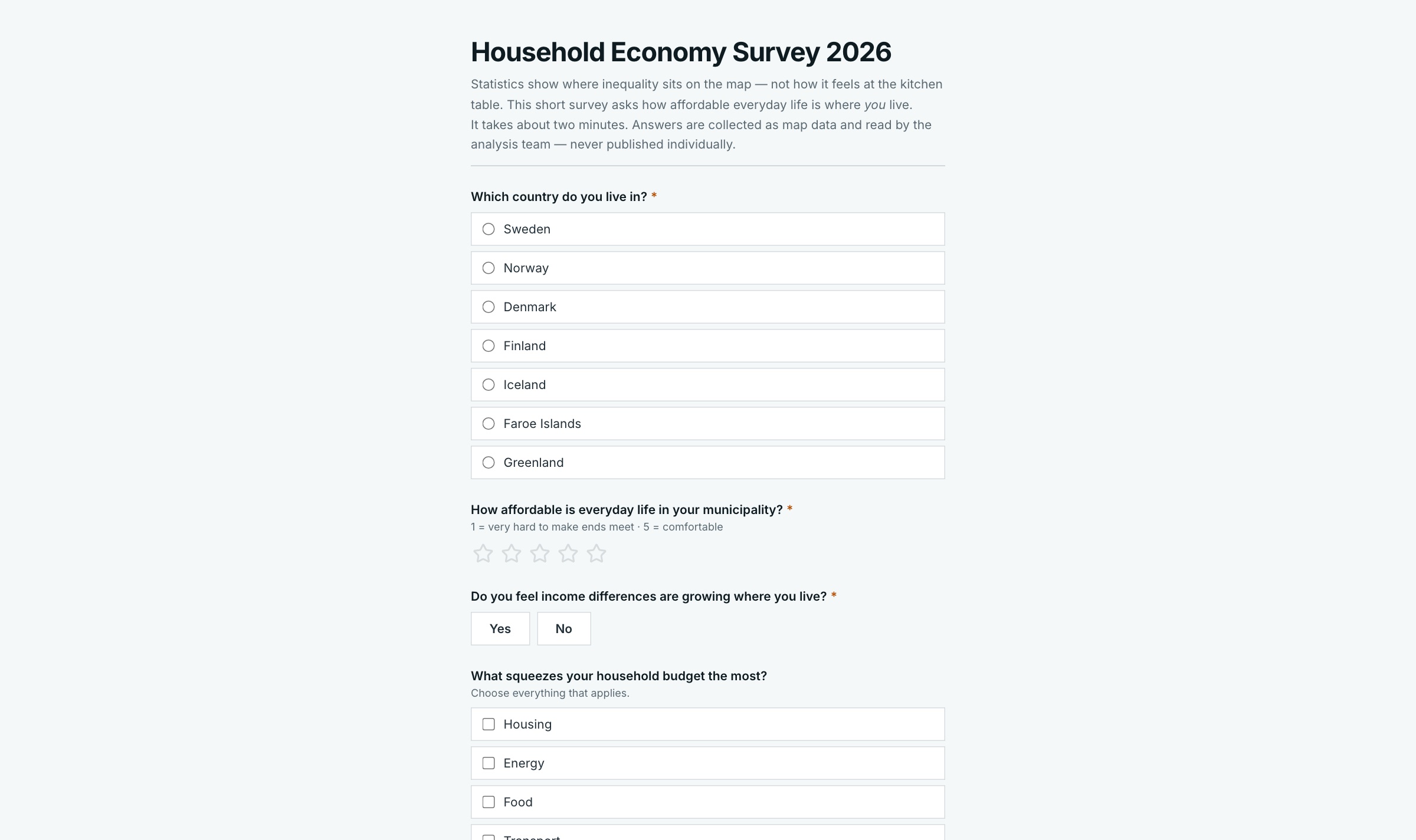
Surveys is a form builder that ends in map data instead of a spreadsheet. You assemble questions from a palette, text, numbers, choices, yes/no, dates, star ratings, and a location picked on a map, while a live preview shows the form exactly as respondents will see it, in your organization's theme. When you publish, OrbGIS sets up the response layer for you: one column per question, and every answer with a location becomes a point on the map.
Collecting answers is as simple as sharing a link. Anyone in your organization can fill in the form right away, or publish it to the web and let anyone respond, no account needed. Every submission is checked before it's accepted, so required fields stay required and your data stays clean.
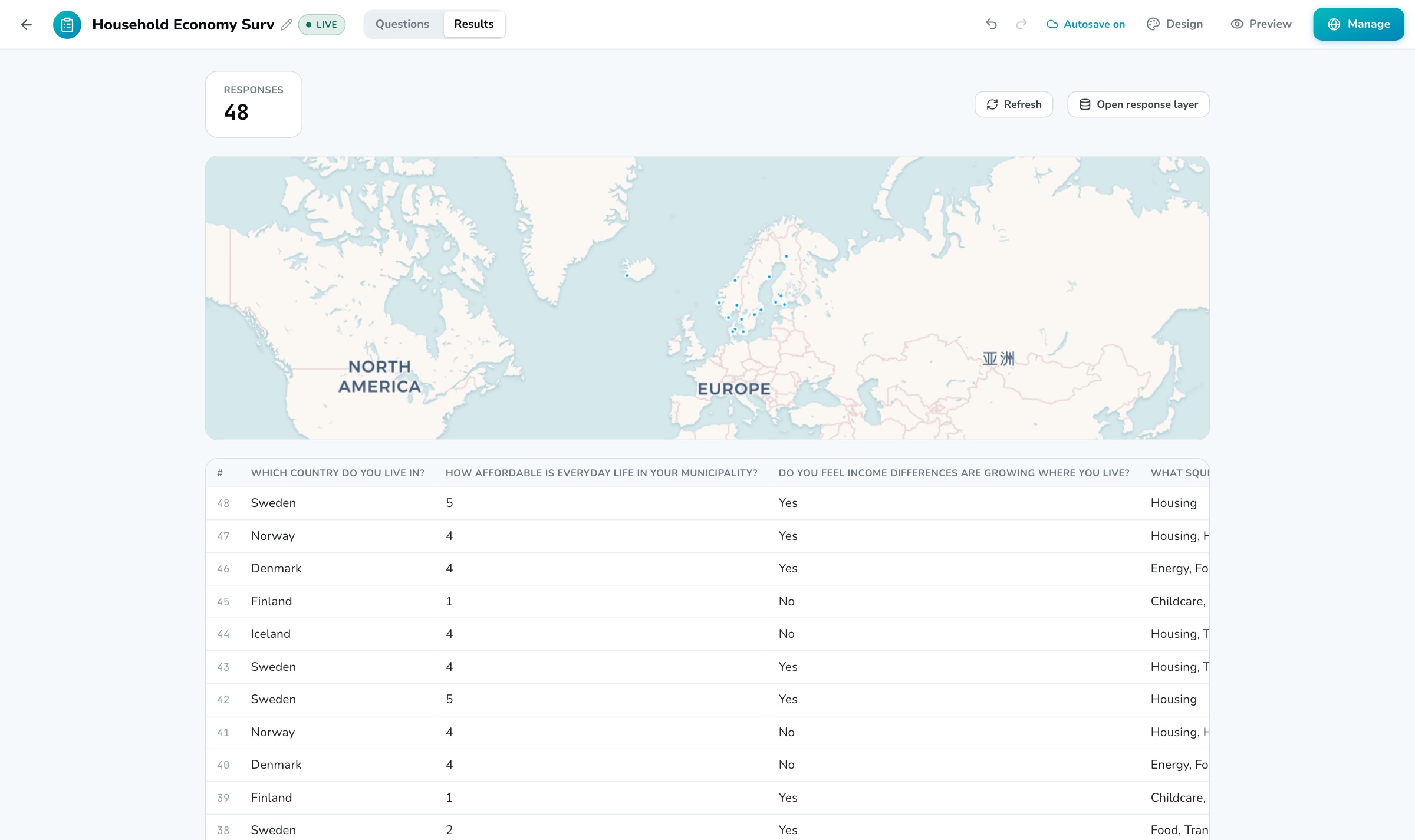
Responses are ordinary layers, so there is no export step. The Results tab shows a live count, a response table and a map of the latest points, and updates the moment someone submits. The same layer opens in the map viewer and feeds dashboards like anything else. A field crew logs a fallen tree; the operations map has the point before they've pocketed the phone.
Text, paragraph, number, single or multiple choice, yes/no, date, date & time, star rating, and a location question where respondents click the map or use their current position.
Publishing creates a response layer in your content: one column per question, locations as points on the map. Style it, filter it and chart it like any other layer.
Publish to the web and the form runs on your organization's own address, no account needed to respond. Every answer is checked on the server, so nothing lands in your data that the form didn't ask for.
A live response count, a table with your questions as column headers, and a map of the latest points. Leave the tab open and watch the answers arrive.
Questions on the left, settings on the right, and the actual form in the middle, exactly as respondents will see it, in your organization's theme. Your work saves automatically.
Draft, published, closed. Questions lock when you publish so your data stays consistent, and you can close a survey to stop accepting responses and reopen it later. Deleting the form keeps the data.
Design a form, publish it, and watch answers land in a live dataset, one column per question, with the location answer as point geometry.
→Collect field data with a themed form that writes straight into a live feature layer, respondents only need a link, not an account.
→Two independent switches govern who sees what: Ownership (Private or Organization) inside your org, and Publishing for the open web, apps only, with a clear exposure check.
→Datasets are OrbGIS’s working unit: hosted feature layers and attribute tables with typed fields, relationships, statistics, and vector tiles behind every map.
→
No demo call. No sales funnel. Sign up to make your first map.